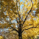
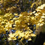
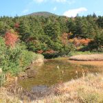
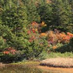
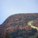
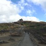
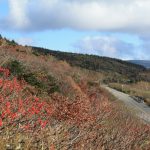
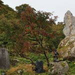
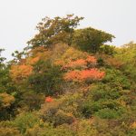
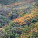
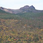
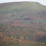
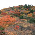
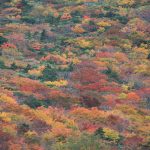
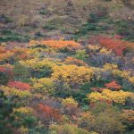
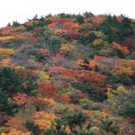
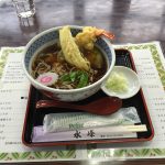
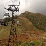
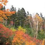
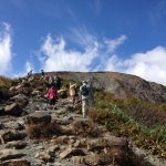
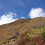
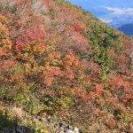
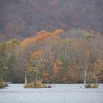
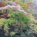
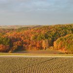
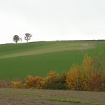
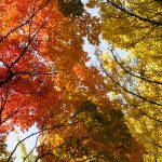
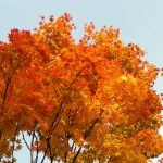
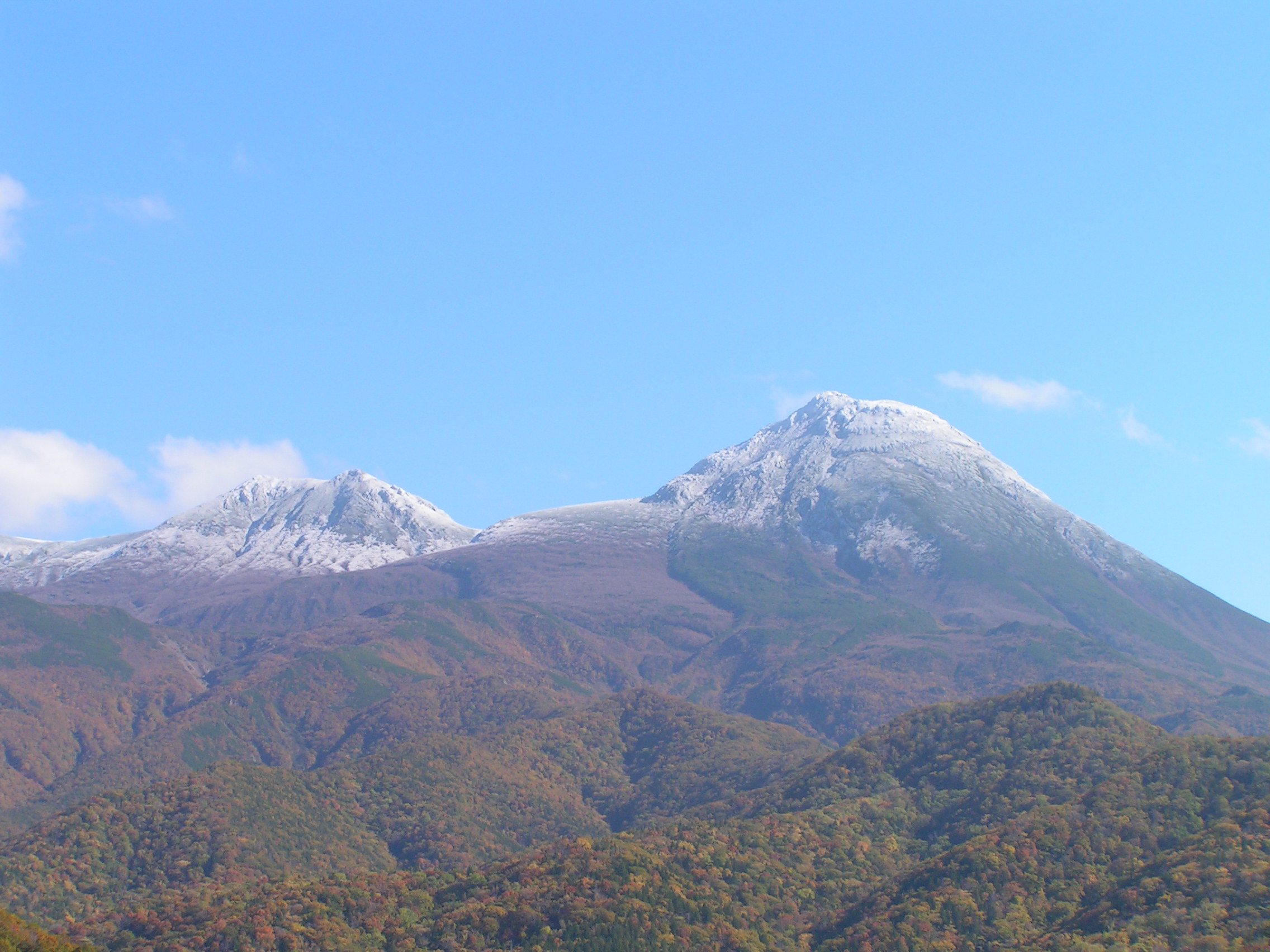
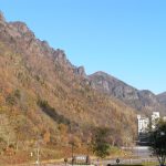
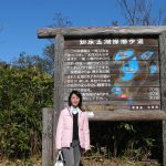
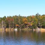
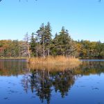
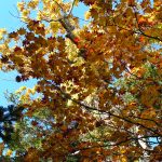
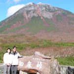
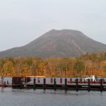
Visited Nasu-dake on 16th Oct (Sunday) by Tohoku Shinkansen to Nasu-Shiobara, then by bus. Bus took 1hr+ but traffic grinded to a halt after passing Nasu-Kogen, before reaching the Nasu ropeway as the final stop. The bus driver was nice to suggest that hiking to the ropeway was possible in about 20min. Some of the passengers included me of took his suggestion. It was quite a steep climb along the road and also cutting through via footpaths. I finally reached the ropeway station after noon time. Realized that so many people were visiting, I had a quick soba then queued up for the ropeway. Reached the top station @1684m past 1pm, then quickly commenced hiking. Though it was a clear day, strong gusty wind blew amidst a very steep climb. About 30min later, I was rewarded with gorgeous views of Koyo laden Nasu-dake. With another 45min to reach the summit of Chausu-dake @1800m, I decided to turn back at that point. There was no more Koyo upward, and I needed to queue for both the return ropeway and bus.
Queued for bus after 2:30pm. Slightly after 3pm the bus arrived and the bus driver nicely let us embark, though it could not depart before 3:30pm. The bus was so full. I was lucky to have a seat while some had to stand for more than 2 hours before reaching the nearest JR station. Traffic was really heavy.
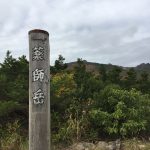
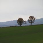
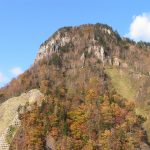
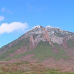
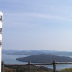
Nasu-dake junction @1718m, with Chausu-dake in view
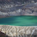
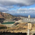
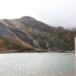
drove along the Zao Eco-line with nice Koyo views around 1400-1500m. Reached a car park and took lift to Okama at about 1700m.
Had seen photos of Okama before but was stunned at its huge size. The crater lake was filled with turquoise water and it was truly beautiful, with a backdrop of blue sky and moving white clouds in the distance.
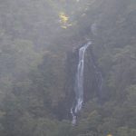
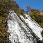
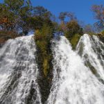
Hiked for about 15min to reach the summit of Toggata @1759m. As usual, there is a small Jinja up there. Though it is a normal weekday, there were many visitors, while the nearby payable car park was full. on the way back to Fukushima city to return car, stopped by a waterfall viewing deck then Toggata onsen town, which I last visited in 2001 for day onsen.
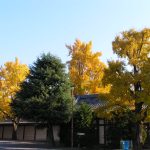
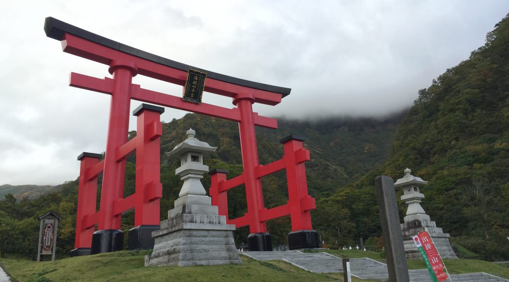
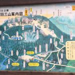
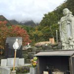
First visit to Dewa Sanzan (出羽三山) in Tsuruoka (鶴岡), in northwest of Yamagata Prefecture, not for fall foliage but for 3 famous sacred mountains. Visited 2 of them in this trip.
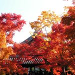
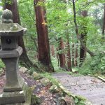
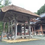
Hagurosan (羽黒山)
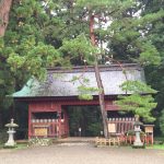
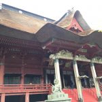
This is the mountain which opens all year round and is easily accessible by bus to the mountain top, where there is a Haguro-san Shrine (三神合祭殿), which houses the deities of the 3 Dewa Sanzan shrines. At the foothill, there is a 5-storied pagoda (五重塔) and the Zuishinmon (随神門), where the approach to the Haguro-san trail begins.
Entrance at the foothill
Zuishinmon – the beginning of the trail
5-storied pagoda
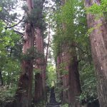
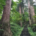
cedar trees along the trail
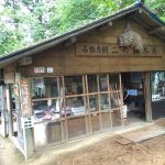
tea house along the trail
Torii gate of Haguro-san
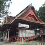
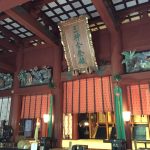
Sanjin Gosaiden – side view
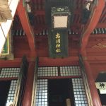
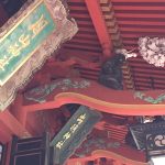
Haguro Jinja
l to r : Yudono Jinja, Gassan Jinja
Sanjin Gosaiden – front view
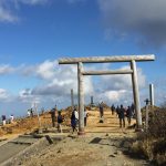
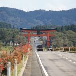
Big Torii gate before reaching Haguro-san area
Yudonosan (湯殿山)
The other sacred mountain symbolizing “rebirth”. Drove via a toll road and took a shuttle bus and started a short walk to the inner shrine. The inner shrine area prohibits photography – all the photos were taken outside of that area, and where all visitors are required to follow a purification ritual on bare feet. This is unique among all the shrines I have visited in Japan.
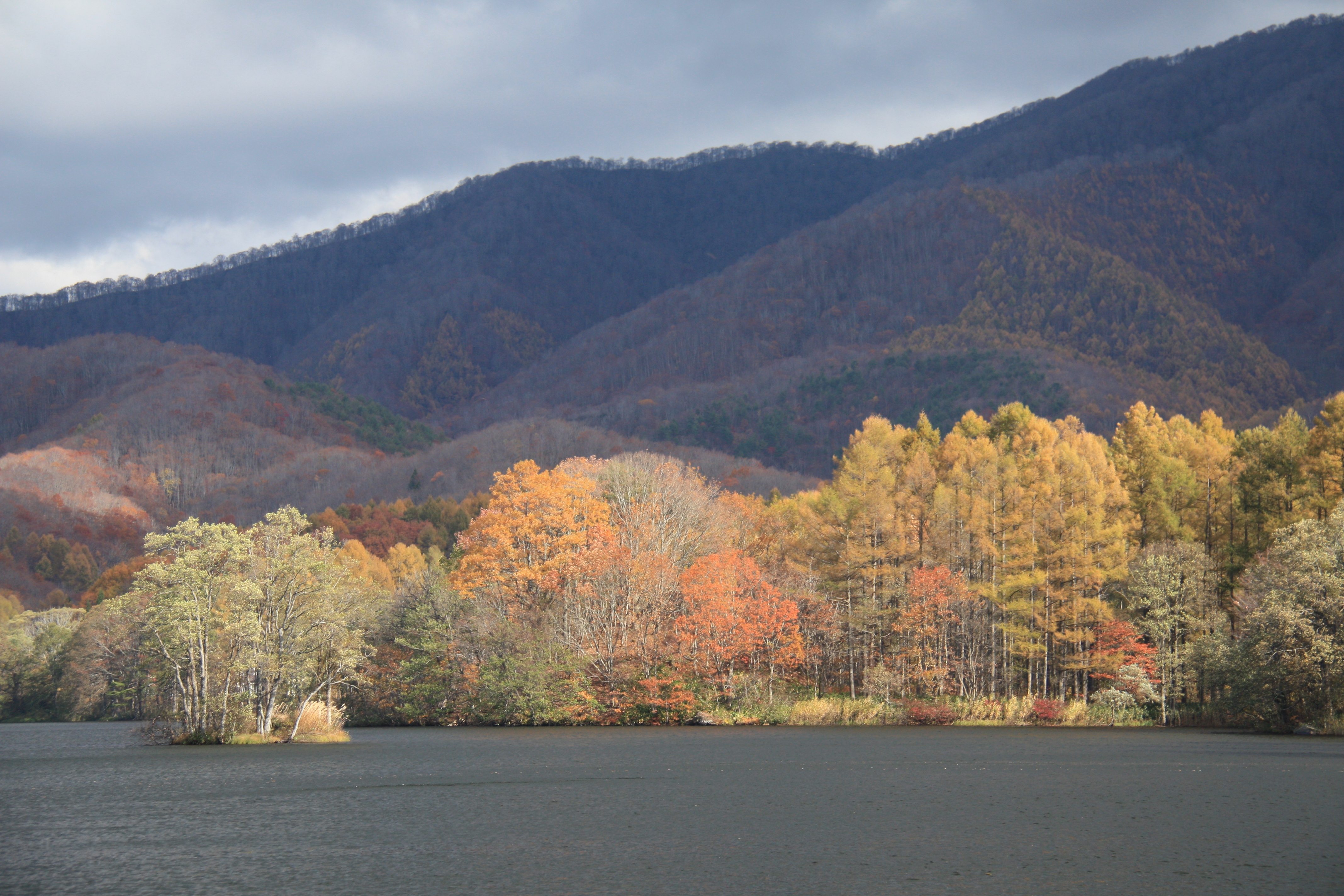
First “Koyo” trip in 2016 in 2nd week of October. Visited Fukushima and Yamagata Prefectures in Tohoku by car. On another day, visited Nasu-dake by public transports. Overall, fall colours were in general 5 to 7 days later than yearly average.
Mt Adatara (安達太良山)
Prior to the visit, noticed from its local blog that peak foliage was about 5 to 7 days later than yearly average.
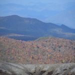
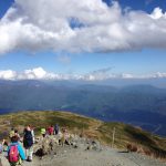
Stayed overnight in Dake onsen prior to heading to Mt Adatara the next day. Picked an onsen ryokan facing the Mirror pond (鏡が池). Drove up to parking lot at the ropeway base and it was full that many cars were parked along the hill slope – I followed 🙂 From the top of the ropeway @1350m, hiked for about 30min to an open area where the summits and peak fall foliage could be viewed clearly. Did not hike up to the summit @1700m (which would take another 2 hrs to return) as I needed to dash for the nearby Bandai Azuma Skyline @1600m.
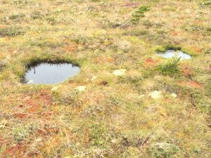
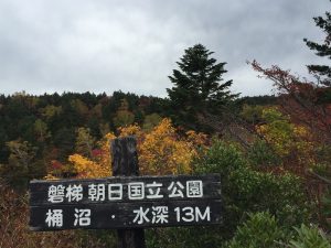
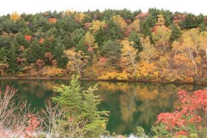
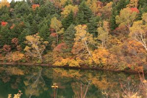
Took about an hour (about 30km) to reach the top Jodo-daira @1600m (浄土平) of the Skyline through numerous elbow turns. Traffic was quite busy even on a weekday, which was a good sign that peak foliage was up there! Took a quick stroll to the nearby Oke-numa (桶沼). Reflections and colours of the small pond was gorgeous ! The best shooting spots were up on two benches and I had to take turns with several local ladies 🙂 One of the many nice things in Japan is that locals are in general courteous and form a queue by themselves if needed.
along Bandai Azuma Skyline
peak fall foliage around 1400-1500m
Shodo-daira @1600m
Oke-numa
viewpoint in Bandai Azuma Skyline
Bandai Azuma Lakeline (磐梯吾妻レークライン)
Left Shodo-daira without lunch – there’s a huge restaurant up on 1600m and the chargeable car park was full! and head straight to Urabandai via the Bandai Azuma Lakeline. Had a quick soba as late lunch nearby Hibara-ko and then head straight to Shirabu onsen ryokan (about 74km) before dusk. As the colours were still greenish at lower elevations I did not bother to stopover. Besides, I had last visited these locations in late Oct 2014.
3rd visit. In previous visits did not complete the full loop due to poor visibility.
Timing – early Oct.
Took gondola to top station @1900m and started hiking. There were facilities before the mountain gate like cafeteria, washroom, visitor info. But once inside, there were only two makeshift toilets about midway uphill. Clouds were covering the mountain tops while fall foliage was past peak. Took about 2hrs to reach the top observation deck @2100m. The deck was fully filled with many hikers. On clear days the Mt Shirouma-dake could be seen. On the return trail, spotted the Tsugaike downhill in deep blue. Took nearly 5hrs back to the mountain gate, including photo time and a break on the deck.
inside the gate @1800m+
view from the top deck – Mt Shirouma was shrouded again
Tsuga-ike !!
clouds and mists cleared up by the time I left around 2pm
2nd visit. Last visit was in Aug 2001, but the Mt Shirouma-dake was shrouded by clouds.
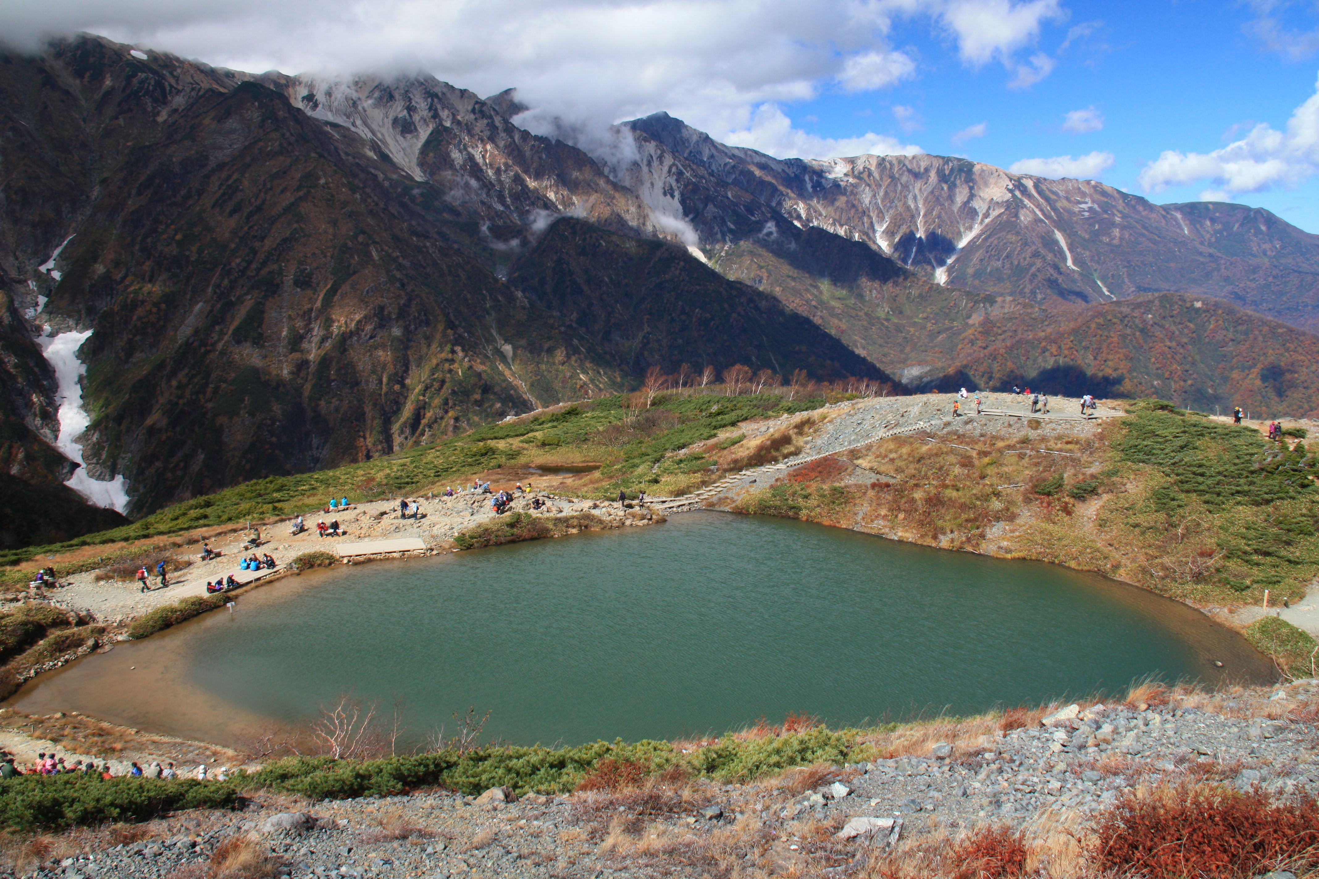
Took gondola and changed ski lifts to top @1800m and started hiking. It looked cloudy downhill but up there the sky cleared up due to strong wind. There were many hikers along the way. Took about 1hr+ to reach Happo-ike @2000m+. So glad that finally the 3 summits of Mt Shirouma-dake of nearly 3000m revealed themselves from fast-moving clouds across the horizon of Happo-ike. Took a break and chatted with 2 locals who were from Yokohama. Returned back downhill and visited a Jinja with 2 huge Sugi of 1000 years old.
Visited Urabandai 4 times before but all by public transports. In this trip, rented a car from Fukushima and drove along the Bandai Skyline to Urabandai and stopped by Nakatsugawa, whose fall foliage was at peak.
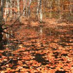
5th visit to Hibara-ko and Goshiki-numa. Fall foliage was slightly after peak though scenery in smaller ponds such as Renke-numa, Sohara-ko looked awesome. Walked along parts of the Goshiki-numa trail again – a bit disappointed in Ruri-numa and Bishamon-numa as foliage has faded and many leaves had fallen.
Hibara-ko
Renke-numa
Sohara-ko
Akimoto-ko
Yana-numa
Ao-numa
Ruri-numa – this tree used to look like a large umbrella in red leaves
Bishamon-numa
Aizu-Wakamatsu (會津若松)
Stayed in onsen hotel in Hibara-ko. On next morning, headed to Aizu-Wakamatsu to visit its castle and we were lucky to have peak foliage. Stayed in Higashiyama onsen uphill from city centre.
On next day, drove past Inawashiro-ko and returned car in Koriyama. Stayed in Tokyo over weekend before leaving Japan.
Visited Oirase, Towada-ko and Mt Hakkoda for the 1st time. Re-visited part of Urabandai but added new locations such as Nagatsugawa, Aizu-Wakamatsu etc.
Oirase stream (奧入瀨溪流)
It stretches for about 14km, draining water from nearby Towada-ko. There are easy foot trails covering most of the stream. As we visited during peak Koyo season by car, we stopped by at various scenic spots and did not cover the entire trail on foot.
Shoshi-Otaki
Kumoi-no-taki
Ashura-no-nagare
Samidare-no-nagare
stream and forest on the back of our onsen hotel
swamps in Yakiyama
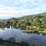
Towada-ko (十和田湖)
Visited the observatory by car. As most of the lake rim is surrounded by cliffs without road access, we took the lake cruise which offered stunning views of Koyo. These views reminded us of our past visits in Chuzenji-ko in Oku-Nikko. There are easy walking paths along the lake rim, along the pier.
foot paths along the lake rim
observatory accessible by car, but road is steep and narrow
view from pier
Hakkoda-san (八甲田山)
Took the ropeway to top station @1600m and followed foot trails for an easy walk. Koyo has already finished leaving pale brown forest views along the ropeway ride. Along the foot trails, there were lush green coniferous forests, dotted by occasional ponds.
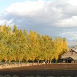
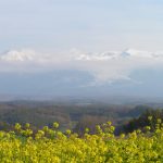
Drove to Tomita Farm in Kami-Furano. When we arrived at Hinode (sunrise) garden in Biei after 3pm, sun was slowly setting and it shined a warm yellowish orange glow in the fields, a slightly pink glow in the far away Mt Tokachi range.
Tomita farm
Biei
Biei
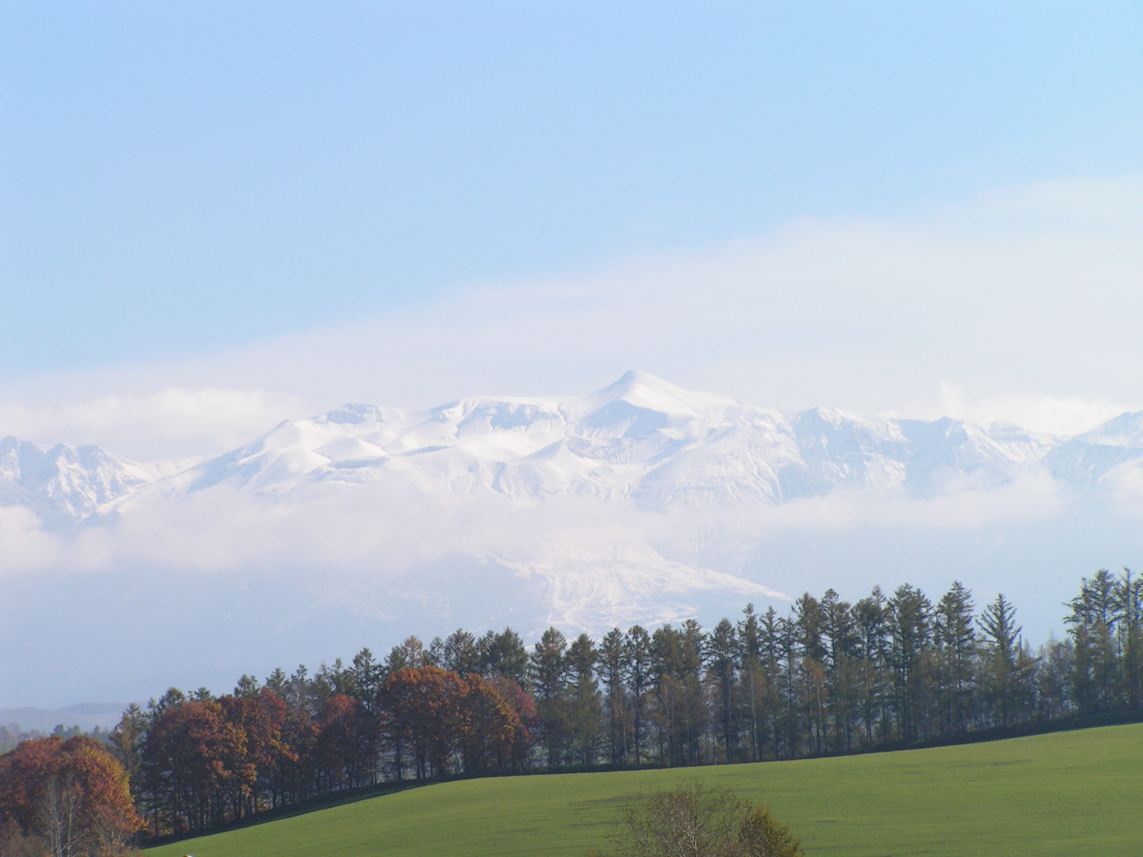
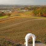
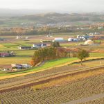
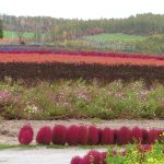
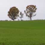
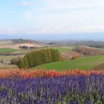
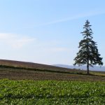
On the next day, we continued our visits in Biei. First we went to Flowerland where the deep red Kochia quickly caught our attention, whereas the pink Cosmos is a widely seen in Autumn Hokkaido. Next we quickly drove around the Patchwork road to visit the Mild-Seven trees, the family trees, Ken & Mary tree, the Philosophical tree – our favourite. From Shikisai-no-oka, we noticed the Mt Tokachi range was well covered in snow (in the distance), so we headed up to the mountain gate where it was covered in snow.
Flowerland
Family tree
Ken & Mary tree
Mt Tokachi range
Philosophical tree
Mt Tokachi from Biei
X’mas tree
Sapporo
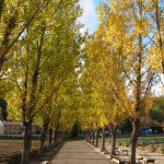
in Sapporo, fall foliage was probably at 70% peak. Visited the campus of University of Hokkaido, and Nakajima Park.
Returned to Hokkaido for a 10-day trip from mid to late October by car. This was to time for peak fall foliage in places like Shiretoko, lakes in Teshikaga, Tokachi, Biei/Furano etc.
Sounkyo > Abashiri (層雲峽 > 網走)
Took JR express train to Asahikawa straight from New Chitose airport. Next morning picked up rental car and arrived at Sounkyo around noon. Fall foliage obviously has passed its peak as expected. Visited the dual waterfall – Ginga-no-Taki (Milky Way Galaxy waterfall) and Ryusei-no-Taki (meteor waterfall). Next day, stopped by Mt Tento in Abashiri while driving to Shiretoko. From Mt Tento, Abashiri-ko and Okhotsk Bay can be seen.
Ginga-no-taki, Ryusei-no-taki
Sounkyo
Daisetsu dam
Tentosan in Abashiri
Abashiri-ko
Shiretoko 5 lakes (知床五湖)
Stayed in a nice onsen hotel in Utoro town (see ONSEN page). Next day visited World Heritage Shiretoko 5 lakes. It was an easy walking trail. Fall colours were not that brilliant – peak might have passed. Bumped into wild deers so everybody around suddenly went silent. Afterwards, drove to Shiretoko-toge (Pass) for a close-up view of Mt Rausu, whose summits were already covered by some snow patches. On the way to Shari, stopped by Oshikoshin-no-taki (waterfall).
Shiretoko national park
walking along the trails of 5-lake area
Mt Rausu range
wild deers
Mt Rausu
Shiretoko toge (Pass)
Oshinoshin-no-taki
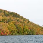
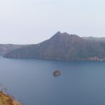
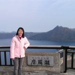
Kussharo-ko, Mashu-ko, Akan-ko (屈斜路湖 >摩周湖 > 阿寒湖)
2nd visit to these 3 lakes we like most in Hokkaido East. Drove to Bihoro-toge (Pass) and Wakoto Peninsula for nice views of Kussharo-ko. Stayed in Kussharo-ko onsen hotel as we love the serene lakeview from hotel room. On next day we went to Mashu-ko. Unlike in May we finally had a panoramic view (clear of fog) from 3rd observatory deck. Finally, we went to Akan-ko and stayed in Tsuruga onsen hotel (see ONSEN page).
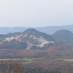
From Tokachi we drove to Tokachigawa for our favourite onsen in Hokkaido, while stopping by Ikeda for lunch, where it produces wines from local grapes. On next day, we drove to Furano, stopping by Shintoku for famous soba produced locally when a rainbow showed up briefly. Next we drove past Minami-Furano where some colourful foliage was along the road.